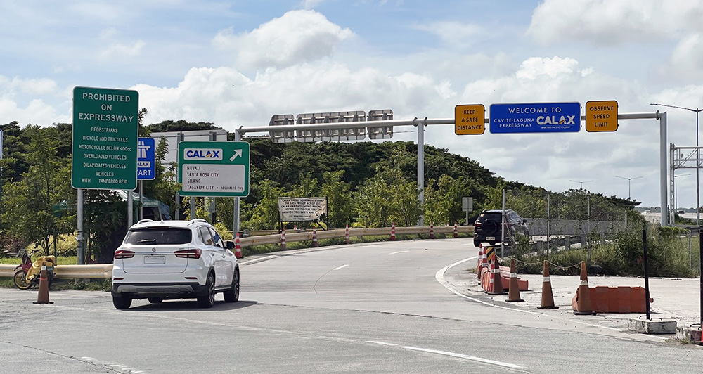
Yesterday, the country woke up to the unwelcome news that Taal Volcano had risen from its slumber, and was already spewing ash and hot lava into the air. We already wrote about the unsafe use of air-conditioning in cars and why you should avoid driving through falling ash if at all possible. But many of us won’t have a choice when it comes to this, so accurate information is currently in high demand. Luckily, the amazing folks over at the Philippine Institute of Volcanology and Seismology have created HazardHunterPH, a website that lets you create indicative hazard assessment reports based on your location.
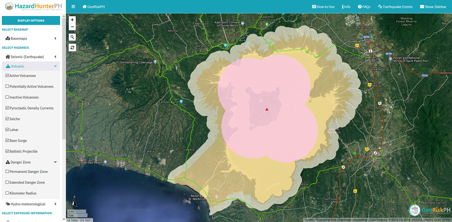
Simply load the map on the website and look for your location. Double-click on it and the site will create a hazard assessment and inform you of the main risks you might be facing wherever you are. This seems to apply to current events (such as the Taal eruption right now), and also to those that may happen in the future (such as earthquakes). Aside from checking your precise location, the site also lets you scroll around and use various filters to see the risk of natural disasters affecting certain areas. For the Taal eruption, for example, the map lets you select relevant filters that clearly show you the minimum area you should stay the hell away from, potential danger areas if the eruption intensifies, and—of great importance to motorists—roads to avoid.
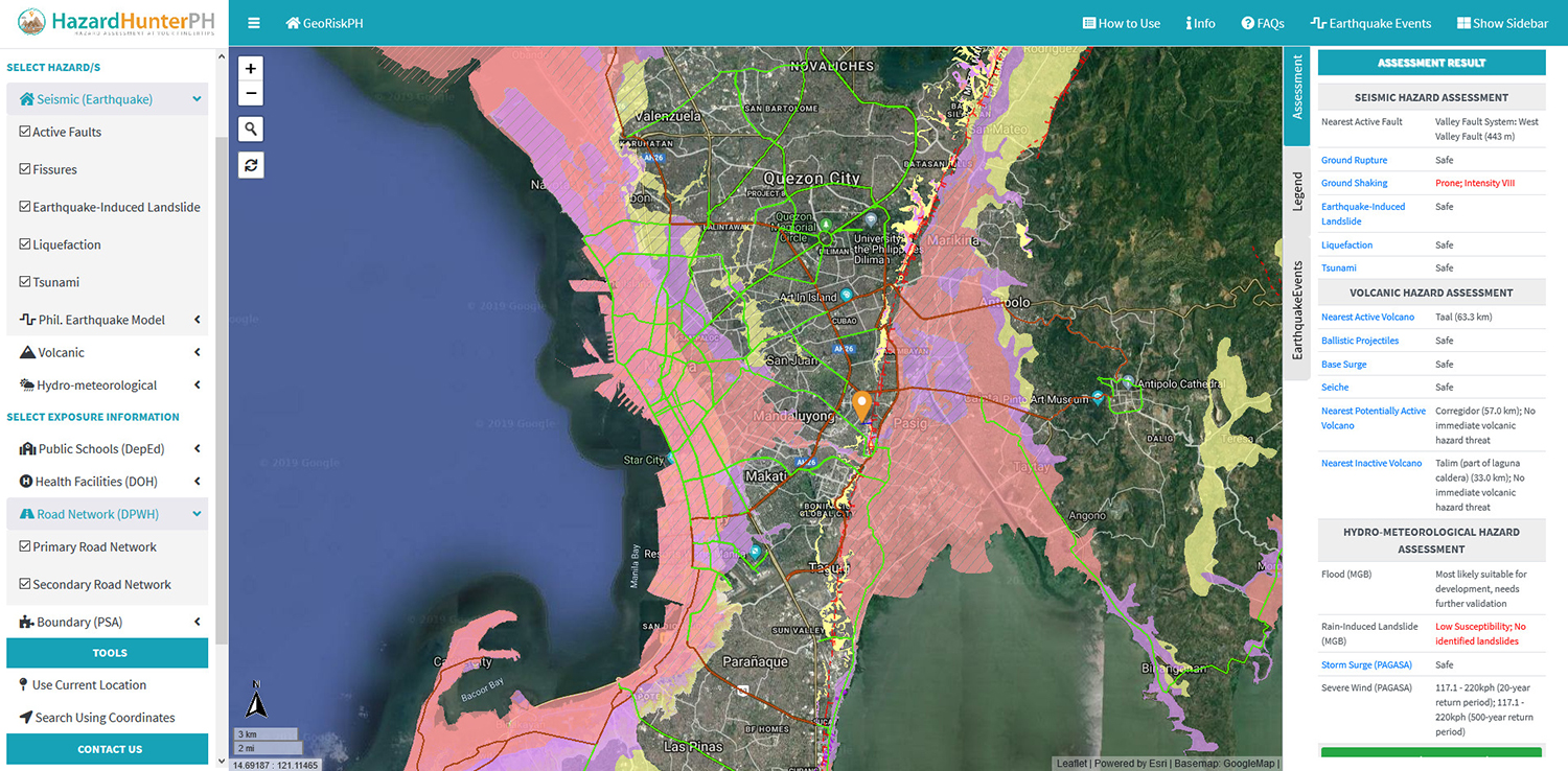
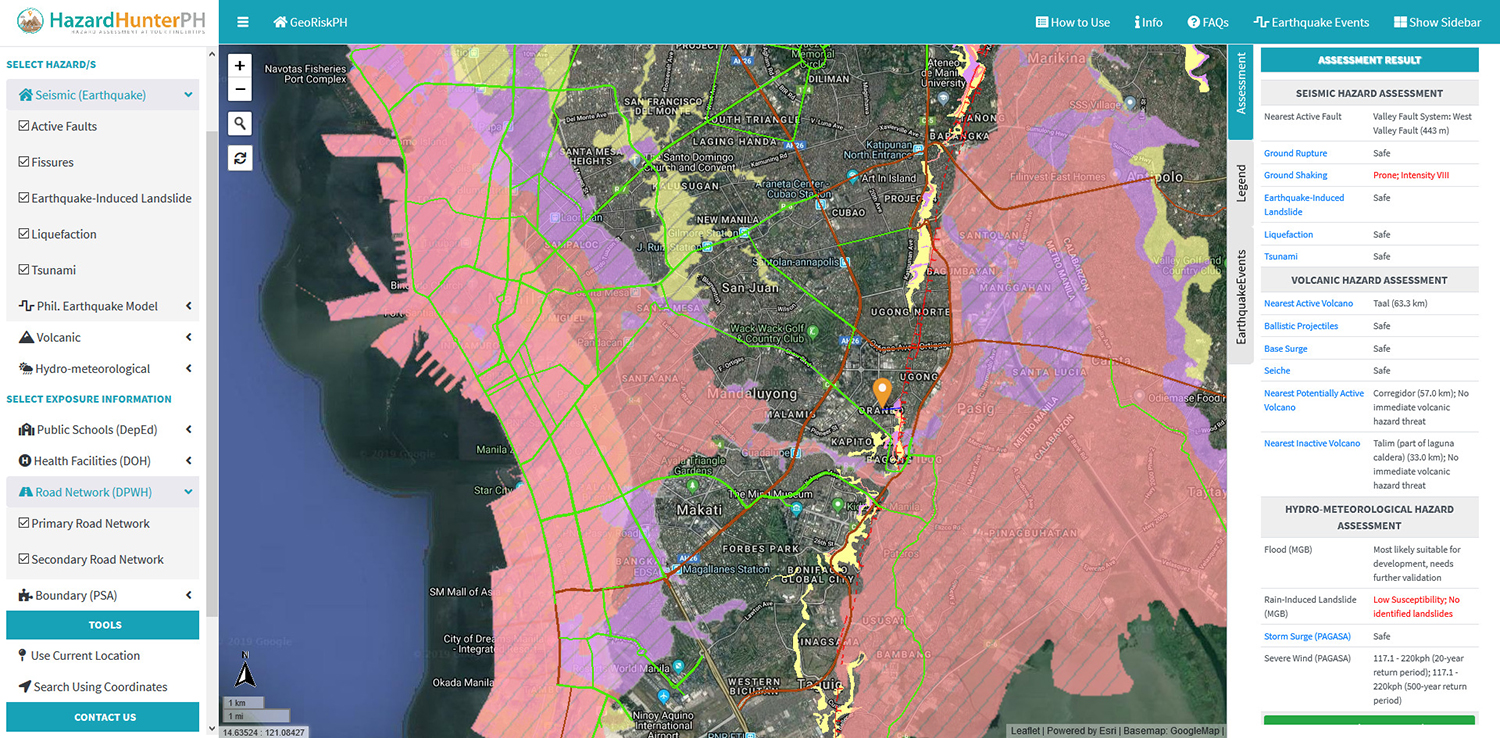
While this is quite useful to car drivers right now—especially if you have to go near Taal for whatever reason—we think another strong point of this system lies in its ability to let you plan ahead. The current eruption took everyone by surprise, as natural disasters have a nasty habit of doing that. We therefore recommend that you not only do a risk assessment for the location of your residence, but also take some time and check the escape routes from that area. The biggest future risk is no doubt a massive earthquake shaking Metro Manila. If you apply the Seismic filters on the map to show you active faults and areas where fissures, earthquake-induced landslides, liquefaction and even tsunamis might hit, and then combine them with the Road Network filters, then you will realize that the number of roads that might not be safe to drive on after such an event is considerable. Planning is crucial here, and you best do it before something happens.
The HazardHunterPH website isn’t a real-time system, so it is best taken as an unofficial guide when it comes to checking, say, how close you can safely get to an active volcano. As to how reliable or credible this website is, the following description should inspire confidence in its users: “All information used for the calculation of hazard assessment results is based on the most recent updates provided by the corresponding mandated government agencies through the GeoRiskPH integrated system.”
GeoRiskPH (which is short for Geospatial Information Management and Analysis Project for Hazards and Risk Assessment in the Philippines) is “a multiagency initiative led by PHIVOLCS, funded by the Department of Science and Technology, and monitored by the Philippine Council for Industry, Energy and Emerging Technology Research and Development.”
Whatever you do out there, stay safe and try not to drive if you don’t have to.


Comments