How many times have you traveled to a foreign city and marveled at how efficient its public transport system is? And by efficient, we’re referring not just to the advanced transit technologies that they use, but also to the body of information readily available to all commuters (both locals and tourists).
Now, do a little tour of Metro Manila. Then tell us how easy it is to get lost. We’ve lived in this place all our lives and we still have a difficult time getting to certain places unless an Uber vehicle drops us off right at the doorstep of our destination. Street signs are often missing. You don’t know which mode of transport gets to which area. Bus stops aren’t strategically and accessibly located. Safe pedestrian pathways are not so common.
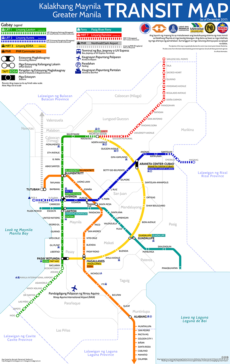
Imagine how challenging and frustrating it must be for tourists to get around our beloved National Capital Region. The experience is probably like joining The Amazing Race, blindfolded. Most amusing of all, there doesn’t seem to be a single decent transit map of Metro Manila in existence. We sure as hell would buy one, if only to find hidden restaurants we keep hearing about from friends.
Thankfully, a guy by the name of Bernardo Arellano III made one—in his free time. Arellano, who describes himself on his Facebook page as a traveler and a geography student, says this map project was just a hobby, and points out that the reason we don’t have an official transit map is that our existing transit systems are owned and operated by different companies that don’t really care if we’re able to hop from one platform to another conveniently and comfortably.
Arellano offers his transit map’s free use to anyone interested as long as it’s for noncommercial purposes. You may download the high-resolution file here, but here’s the map in all its graphic glory if you just want to see what a passionate citizen can accomplish.







Comments